)
)
)
)
)
)
)
Download the APK of GPS Live Satellite View Map for Android for free. Advanced GPS navigation with offline maps and live traffic updates. GPS Live...
GPS Live Satellite View Map
Download APK
(48 MB)
Screenshot
Description
Content
GPS Live Satellite View Map is an advanced navigation app designed to provide a reliable, accurate, and intuitive mapping solution. It is ideal for those seeking real-time traffic updates, precise turn-by-turn navigation, and vivid satellite imagery—all consolidated into a single, user-friendly platform.
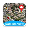
One of the most impressive features is its real-time satellite view, which allows users to see their surroundings from a bird's eye view. This feature is particularly beneficial when navigating unfamiliar areas, offering a comprehensive visual layout of streets and landmarks around you. It enhances travel and driving experiences by giving clear representations that aid in orientation and route planning.
GPS Live Satellite View Map
GPS Live Satellite View Map is a mobile application that utilizes Global Positioning System (GPS) technology and satellite imagery to provide users with real-time location tracking, navigation, and mapping capabilities. It offers a comprehensive suite of features designed to enhance the user's experience while traveling, exploring, or simply navigating their daily lives.
Key Features:
* Live Satellite View: The app provides access to high-resolution satellite imagery, allowing users to view real-time aerial images of their current location and surrounding areas. This feature is particularly useful for planning routes, identifying landmarks, and gaining a broader perspective of the terrain.
* GPS Navigation: GPS Live Satellite View Map offers turn-by-turn navigation with voice guidance, making it easy for users to navigate to their desired destinations. The app utilizes real-time traffic data to provide the most efficient routes, helping users avoid congestion and delays.
* Speedometer: The app includes a built-in speedometer that displays the user's current speed, allowing them to monitor their speed and ensure they are within the legal limits.
* Altimeter: GPS Live Satellite View Map also features an altimeter, which measures the user's altitude above sea level. This information can be helpful when hiking, mountain biking, or engaging in other outdoor activities that involve changes in elevation.
* Compass: The app provides a digital compass that indicates the user's current orientation and the direction they are facing. This feature is useful for navigating in unfamiliar areas or when trying to determine the direction of landmarks or destinations.
* Route Tracking: GPS Live Satellite View Map allows users to track their routes and save them for future reference. This feature is particularly useful for documenting journeys, creating travel logs, or sharing routes with others.
* Map Types: The app offers a variety of map types to choose from, including standard, satellite, hybrid, and terrain. Users can select the map type that best suits their needs and preferences.
* Offline Maps: GPS Live Satellite View Map allows users to download maps for offline use, ensuring they have access to navigation and mapping capabilities even when an internet connection is not available.
* POI Search: The app features a comprehensive database of points of interest (POIs), including businesses, landmarks, restaurants, gas stations, and more. Users can search for specific POIs or browse categories to discover nearby places of interest.
* Share Location: GPS Live Satellite View Map allows users to share their current location with friends, family, or colleagues via social media, email, or text message. This feature is useful for coordinating meet-ups, sharing travel updates, or providing assistance in emergency situations.
Overall, GPS Live Satellite View Map is a versatile and user-friendly app that combines the power of GPS technology with the convenience of satellite imagery. It provides a comprehensive set of features that cater to a wide range of users, from everyday commuters to outdoor enthusiasts. Whether you're navigating unfamiliar cities, exploring remote areas, or simply keeping track of your travels, GPS Live Satellite View Map is an indispensable tool that enhances your mobility and situational awareness.
Information
Version
5.1.1
Release date
Jul 04 2024
File size
48 MB
Category
Casual
Requires Android
Android 5.0 or higher required
Developer
Game Axe
Installs
43
ID
com.gpsaround.places.rideme.navigation.mapstracking
Available on