Download CalTopo APK (1.10.10) for Android for free. Backcountry mapping evolved

CalTopo
Download apk
(17.01 MB)
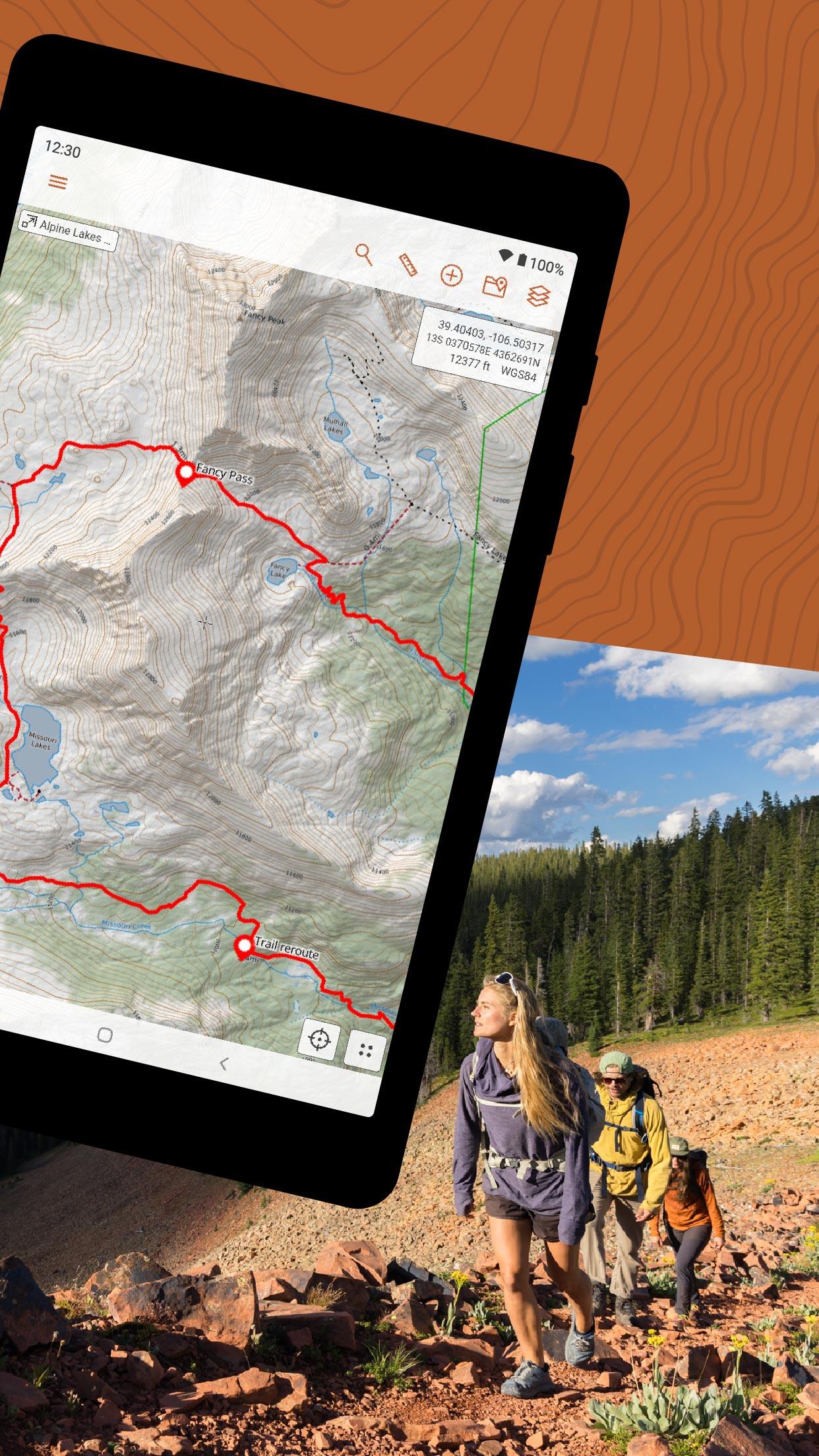
Screenshot
Description
Content
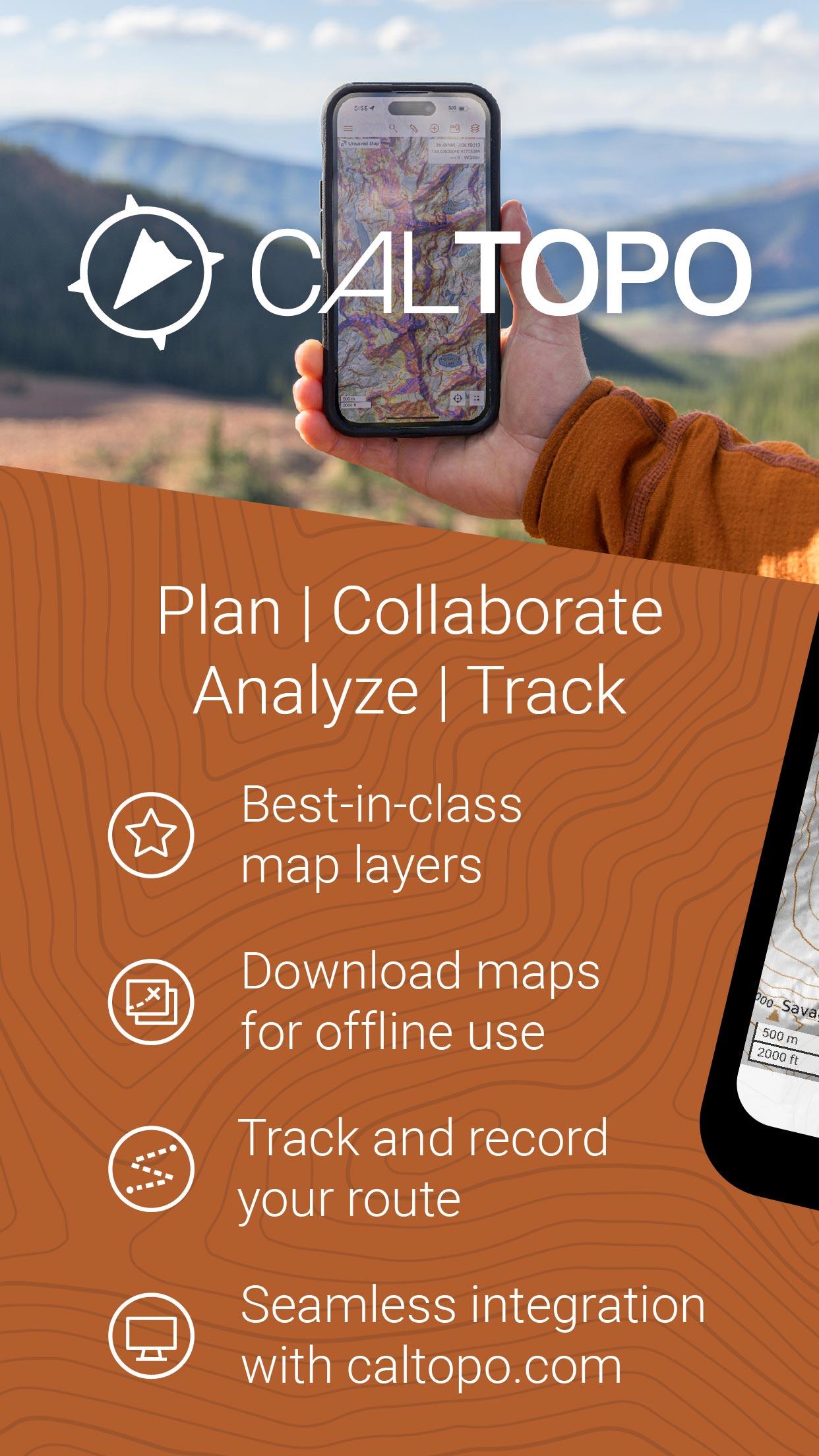
Backcountry mapping evolved
The best backcountry mapping tool on the web is now available on Android.
Cloud Sync
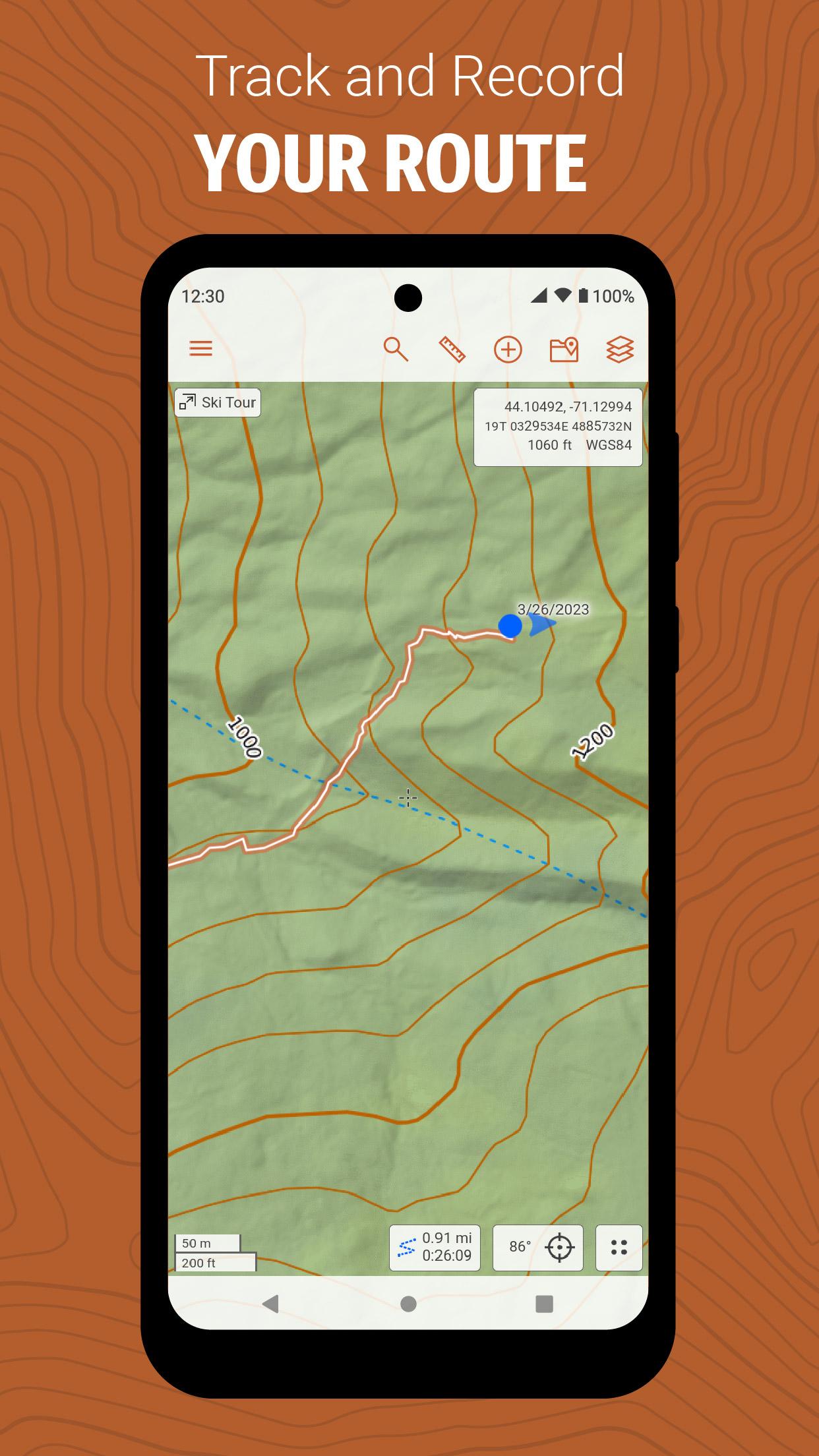
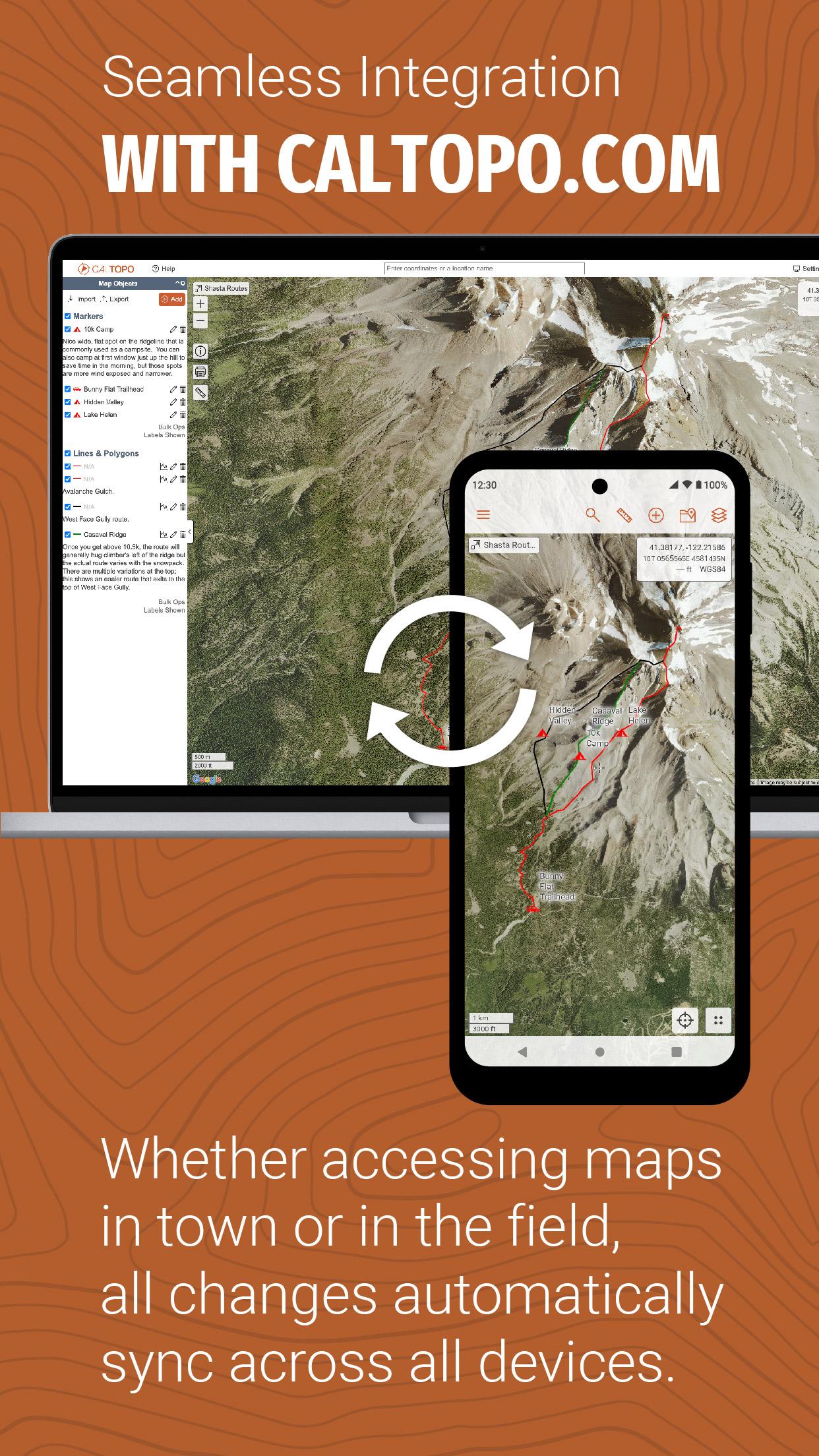
The CalTopo app integrates with your existing caltopo.com account, and edits sync between the two in seconds. Plan your trip using CalTopo's best-in-class mapping tools and then seamlessly transition to your phone. Once in the field, sync your GPS track back to caltopo.com in real time, or drop markers and instantly share them with friends.
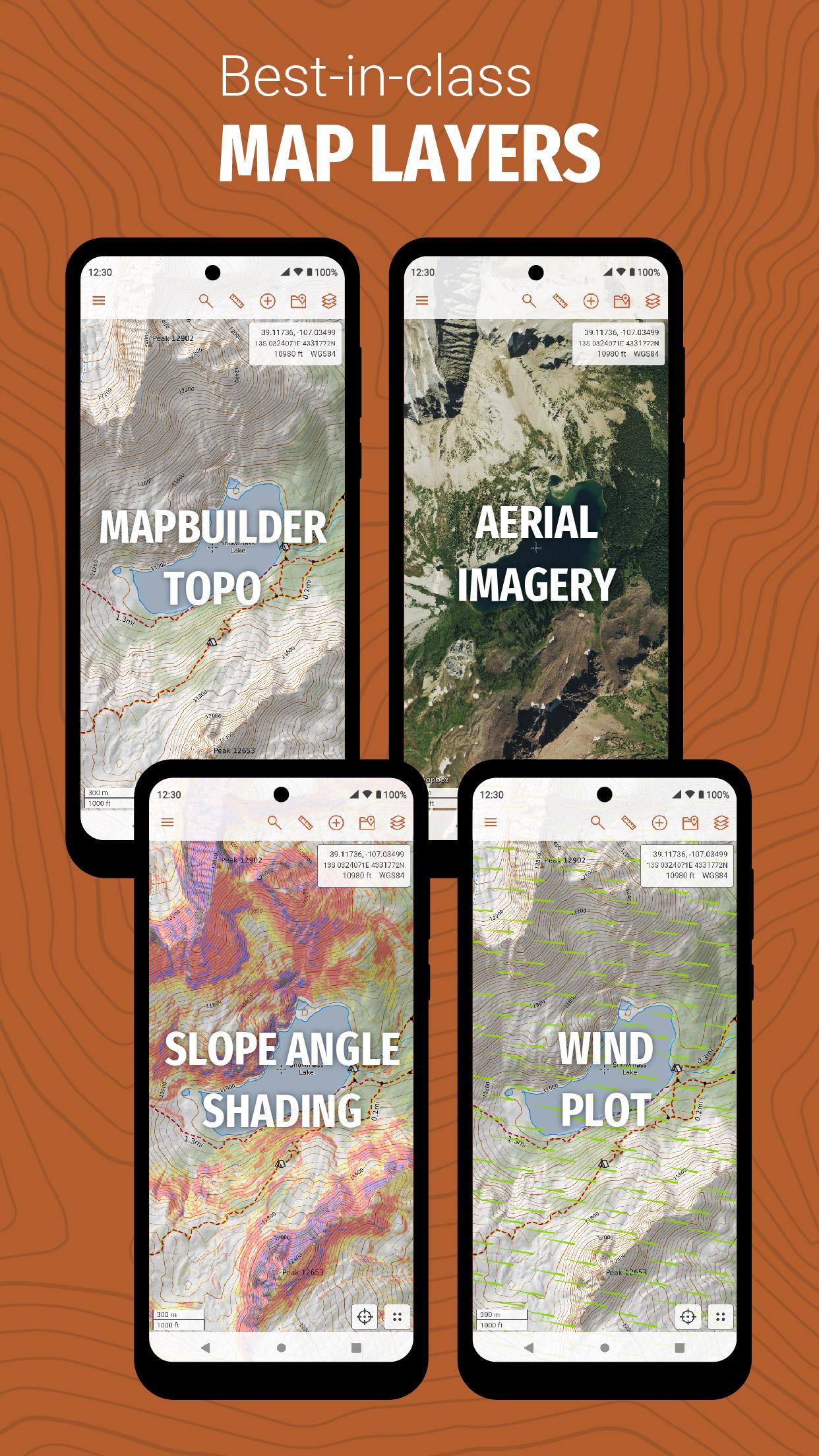
Amazing Maps
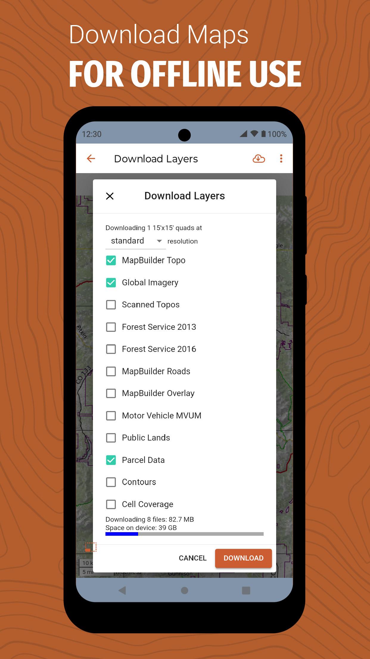
Access CalTopo layers not available elsewhere, including the MapBuilder series, land management, sun exposure, fire activity and custom terrain shading. Pre-packaged map files (subscription required) make for speedy offline downloads and simplified data management. An elevation data layer supports measuring profiles and point elevations, even when offline.
Real-Time Data
NOAA weather forecast visualizations and MODIS satellite imagery aid in-field decision making. Coming soon: SNOTEL, weather stations, streamflows and forecast grid data points.
What's New in the Latest Version 1.10.10
Last updated on Jun 21, 2024
Sync improvements on top of the 1.10.9 build
CalTopo: A Comprehensive Digital Mapping and Analysis Tool for Outdoor EnthusiastsCalTopo is an advanced digital mapping and analysis platform designed specifically for outdoor enthusiasts, such as hikers, climbers, backpackers, and hunters. It offers a wide range of features and capabilities that empower users to plan and navigate their adventures with precision and confidence.
Intuitive User Interface and Data Management:
CalTopo's user interface is intuitive and easy to navigate, making it accessible to users of all skill levels. It allows for seamless management of multiple maps, layers, and data sources, providing a comprehensive view of the terrain and relevant information.
Extensive Map Collection and Customization:
CalTopo offers a vast collection of topographic maps from various sources, including USGS, National Geographic, and OpenStreetMap. Users can customize these maps by adjusting layers, adding custom annotations, and creating personalized map sets.
Elevation Profiles and 3D Visualization:
CalTopo's elevation profile tool allows users to visualize the elevation gain and loss along their planned routes. The 3D visualization feature provides a realistic perspective of the terrain, enabling users to better understand the challenges and opportunities presented by their surroundings.
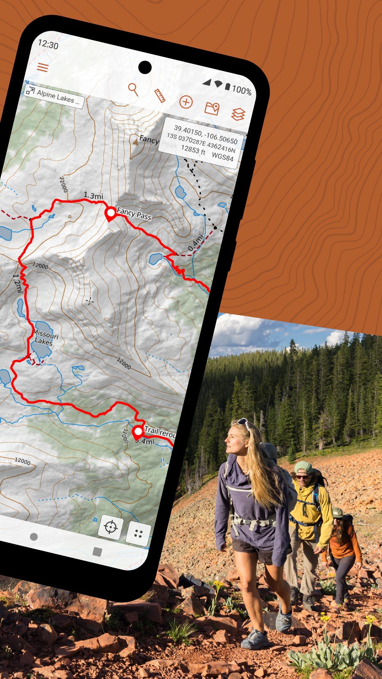
Route Planning and Navigation:
CalTopo's route planning capabilities allow users to create and edit routes with precision. The platform supports multiple route types, including hiking, biking, and driving. It provides accurate distance and elevation measurements, and can generate turn-by-turn directions for seamless navigation.
Slope and Aspect Analysis:
CalTopo offers slope and aspect analysis tools that provide valuable information for route planning and hazard assessment. Users can identify steep slopes, sun exposure, and other factors that may impact their safety and efficiency in the field.
Water Source Identification:
CalTopo's water source identification feature helps users locate potential water sources along their routes. It provides information on springs, lakes, rivers, and other water bodies, enabling users to plan for water availability during their adventures.
Weather Forecasting and Integration:
CalTopo integrates with popular weather forecasting services, allowing users to access real-time and forecasted weather data for their planned areas. This information helps them make informed decisions about trip timing and preparedness.
Community and Sharing:
CalTopo fosters a vibrant community of users who share their knowledge, experiences, and custom maps. Users can collaborate on trip planning, share routes and data, and learn from the insights of fellow outdoor enthusiasts.
Conclusion:
CalTopo is an indispensable tool for outdoor enthusiasts seeking a comprehensive and reliable mapping and analysis platform. Its intuitive interface, extensive map collection, advanced analysis features, and community support empower users to plan and navigate their adventures with confidence and efficiency. Whether it's for hiking, climbing, backpacking, or hunting, CalTopo provides the essential tools to make the most of any outdoor experience.
Information
Version
1.10.10
Release date
Jun 21 2024
File size
17.01 MB
Category
Maps&Navigation
Requires Android
Android 5.1+
Developer
Mohd Firdaus Tarmizi
Installs
100K+
ID
com.caltopo.android
Available on