)
)
)
)
)
)
)
)
Download German Topo Maps APK (7.4.0) for Android for free. Outdoor GPS Navigation with the best maps and aerial imagery for Germany
German Topo Maps
Download APK
(40.5 MB)
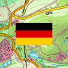
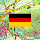
Screenshot
Description
Content
Outdoor GPS Navigation with the best maps and aerial imagery for Germany
+++ NEW ! Introductory Price ! Get the full features for a small one time fee. !!! +++
Easy to use Outdoor/Offline GPS navigation app with access to the best topographic maps and satellite images for Norway.
++ For offline use PRO features needed ! ++
Turn your Andoid Phone/Tablet into an outdoor GPS for trips into the backcountry WITHOUT CELL COVERAGE. See your position on different maps, record your track or share your location with others.
Over 50 different map layers for Germany. 10 map layers with worldwide coverage. Plus many overlays like trekking or bicycle routes.
Use official topographical maps to find small pathes, creeks or contour lines.
High resolution aerial imagery, topo maps in up to 1:5.000, digital terrain modells and even cadastre maps for many German states !
OpenStreetMaps with different layouts.
Free map layers for all Germany
• TopPlus: These high resolution maps use best available geodata from German surveying office (BKG)
• WebAtlasDE
• Satellite imagery
• OpenStreetMaps : These crowdsourced maps are a very useful addition to other map layers. Contain many unique features.
• OpenCycleMaps: These maps are ideal to plan bicycle trips (PRO Users only !)
• ESRI Topographic
• ESRI Aerial Images
• ESRI Street Map
• Google Road Map (online access only)
• Google Satellite Images (online access only)
• Google Terrain Map (online access only)
• Bing Road Map (online access only)
• Bing Satellite Images (online access only)
• Earth At Night
• lots of Overlays like hillshading, rivers, lakes, routes, ...
Main features for outdoor-navigation:
• Create and edit Waypoints
• GoTo-Waypoint-Navigation
• Track Recording (with speed, elevation and accuracy profile)
• Tripmaster with fields for odometer, average speed, bearing, elevation, etc.
• GPX/KML/KMZ Export
• Search (placenames, POIs, streets)
• Customizable datafields in Map View and Tripmaster (e.g. Speed, Distance, Compass, ...)
• Share Waypoints, Tracks or Routes (via eMail, Whatsapp, Dropbox, Facebook, ..)
• Display coordinates in Lat/Lon, UTM or MGRS/USNG (Military Grid/ US National Grid)
• Record & share tracks with statistics & elevation profile
• Rotate map (Track Up & North Up)
• Get Elevation and Distance by long click on map
• Track Replay
• Add custom map tile servers
• and many more ...
Available Pro features: (Pro features available via In App Purchase)
• Offline Use - no cell coverage needed. No Roaming fees !
• Easy+Fast Bulk-download of map tiles for OFFLINE USAGE (not for Google and Bing maps)
• Create and edit Routes
• Route-Navigation (Point-to-Point Navigation)
• GPX/KML/KMZ Import/Export
• unlimited Waypoints & Tracks
• Add other Map Tile-Server
• No Ads
Offline Use:
All viewed map tiles are kept in cache. To cache large areas you need to purchase Pro features.
Use this navigation app for outdoor activities like hiking, biking, camping, climbing, riding, skiing, canoeing, hunting, offroad 4WD tours or search&rescue (SAR).
Add custom waypoints in longitude/latitude, UTM or MGRS/USNG format with WGS84 datum.
Import/Export/Share GPS-Waypoints/Tracks/Routes in GPX or Google Earth KML/KMZ format.
Preload FREE map data for areas without cell service (Pro feature !).
Comments and feature requests to
Have a look at our other outdoor navigation apps: https://play.google.com/store/search?q=atlogis
+++ We DO NOT track any user activities or collect any user data ! +++
What's New in the Latest Version 7.4.0
Last updated on Jul 7, 2024
・BKG-Layer: Neue Namen & Attribution
・Fehlerbehebungen
German Topo Maps is a digital topographic map application that provides detailed and accurate maps of Germany. It is designed for outdoor enthusiasts, hikers, bikers, and anyone who enjoys exploring the German countryside. The app offers a wide range of features, including:
* High-resolution topographic maps: The app uses high-resolution topographic maps from the German Federal Agency for Cartography and Geodesy (BKG). These maps are regularly updated and provide detailed information about terrain, elevation, water bodies, roads, and other features.
* GPS tracking: The app uses GPS to track your location and show you your position on the map. You can also record your tracks and share them with others.
* Route planning: The app allows you to plan routes for hiking, biking, or other activities. You can create routes using waypoints, draw lines on the map, or import GPX files.
* Offline maps: The app can download maps for offline use, so you can access them even when you don't have an internet connection.
* Search function: The app includes a powerful search function that allows you to find places, addresses, and other points of interest.
* Elevation profiles: The app can generate elevation profiles for your routes, so you can see how much climbing you will be doing.
* Slope analysis: The app can analyze the slope of your routes, so you can avoid steep sections if you prefer.
* POI database: The app includes a database of points of interest, such as huts, campsites, and restaurants.
German Topo Maps is a comprehensive and easy-to-use app that is perfect for anyone who enjoys exploring the German countryside. It is available for both iOS and Android devices.
Here are some of the benefits of using German Topo Maps:
* Detailed and accurate maps: The app uses high-resolution topographic maps from the German Federal Agency for Cartography and Geodesy (BKG). These maps are regularly updated and provide detailed information about terrain, elevation, water bodies, roads, and other features.
* GPS tracking: The app uses GPS to track your location and show you your position on the map. You can also record your tracks and share them with others.
* Route planning: The app allows you to plan routes for hiking, biking, or other activities. You can create routes using waypoints, draw lines on the map, or import GPX files.
* Offline maps: The app can download maps for offline use, so you can access them even when you don't have an internet connection.
* Search function: The app includes a powerful search function that allows you to find places, addresses, and other points of interest.
* Elevation profiles: The app can generate elevation profiles for your routes, so you can see how much climbing you will be doing.
* Slope analysis: The app can analyze the slope of your routes, so you can avoid steep sections if you prefer.
* POI database: The app includes a database of points of interest, such as huts, campsites, and restaurants.
If you are looking for a comprehensive and easy-to-use app for exploring the German countryside, then German Topo Maps is the perfect choice.
Information
Version
7.4.0
Release date
Jul 07 2024
File size
40.5 MB
Category
Maps&Navigation
Requires Android
Android 7.0+
Developer
Ashok Swami
Installs
100K+
ID
com.atlogis.germany
Available on