

Download swisstopo APK (1.15.0) for Android for free. Official Swiss Maps
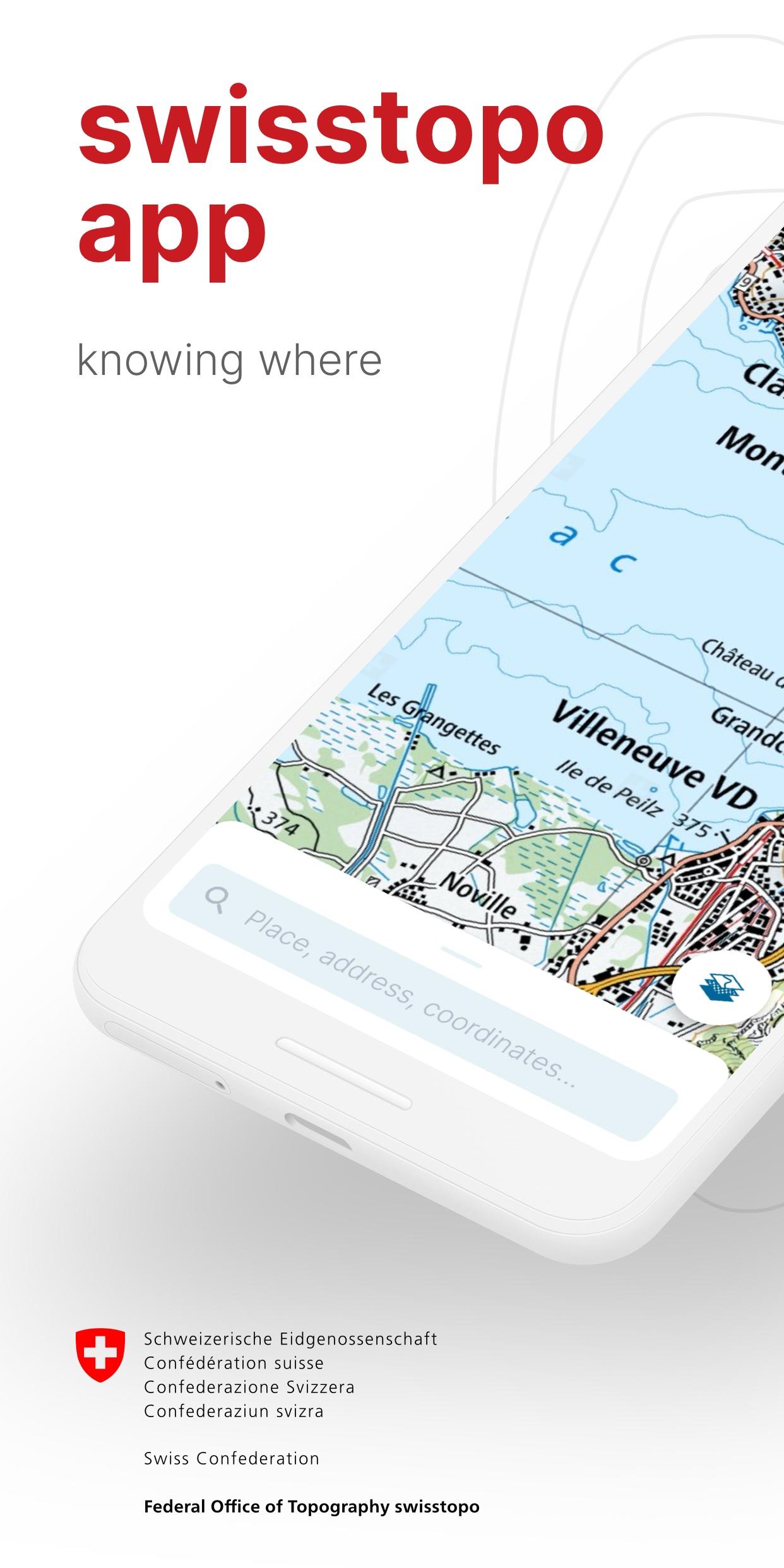
swisstopo
Download APK
(70 MB)
Screenshot
Description
Content
Official Swiss Maps
On the road with the best app of the year: the swisstopo app won the "Master of Swiss Apps 2021" award.
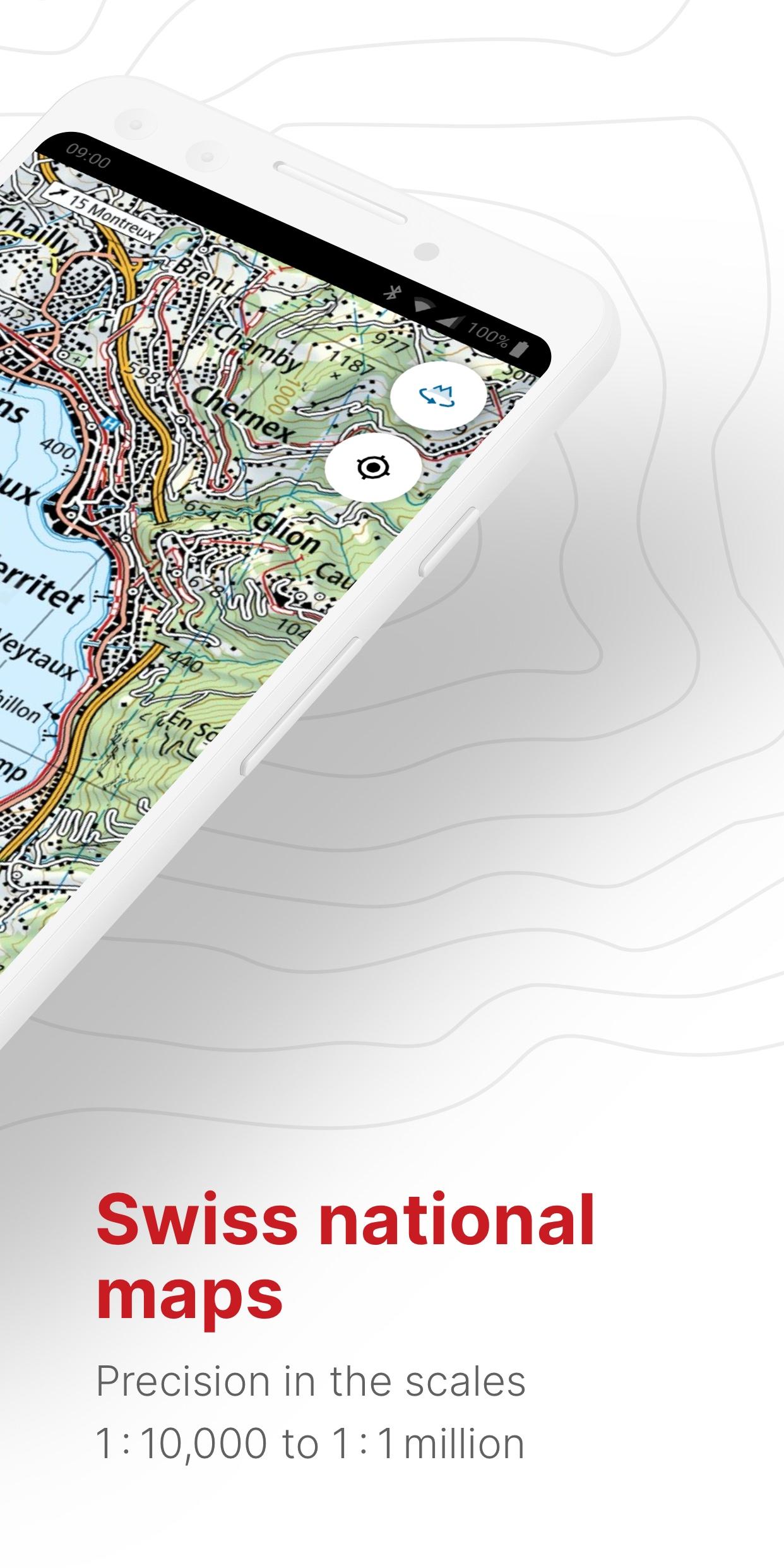
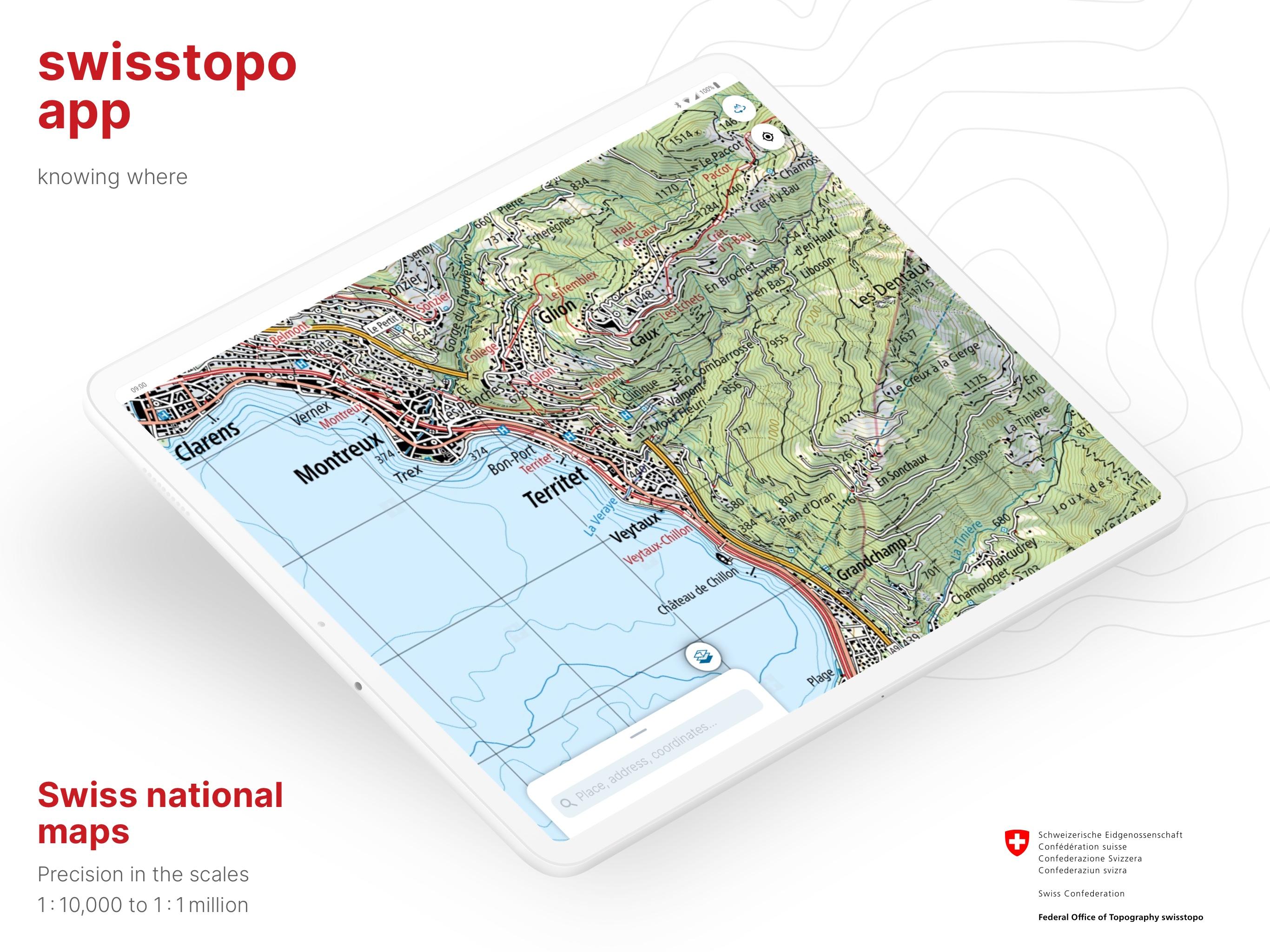
Use the famous national maps to discover even the most remote places in Switzerland and topics such as hiking, cycling, snow sports and aviation. All functions and data of the app as well as offline use are free of charge. The app is free of advertising and does not require a login.
- all scales from 1:10 000 to 1:1 million
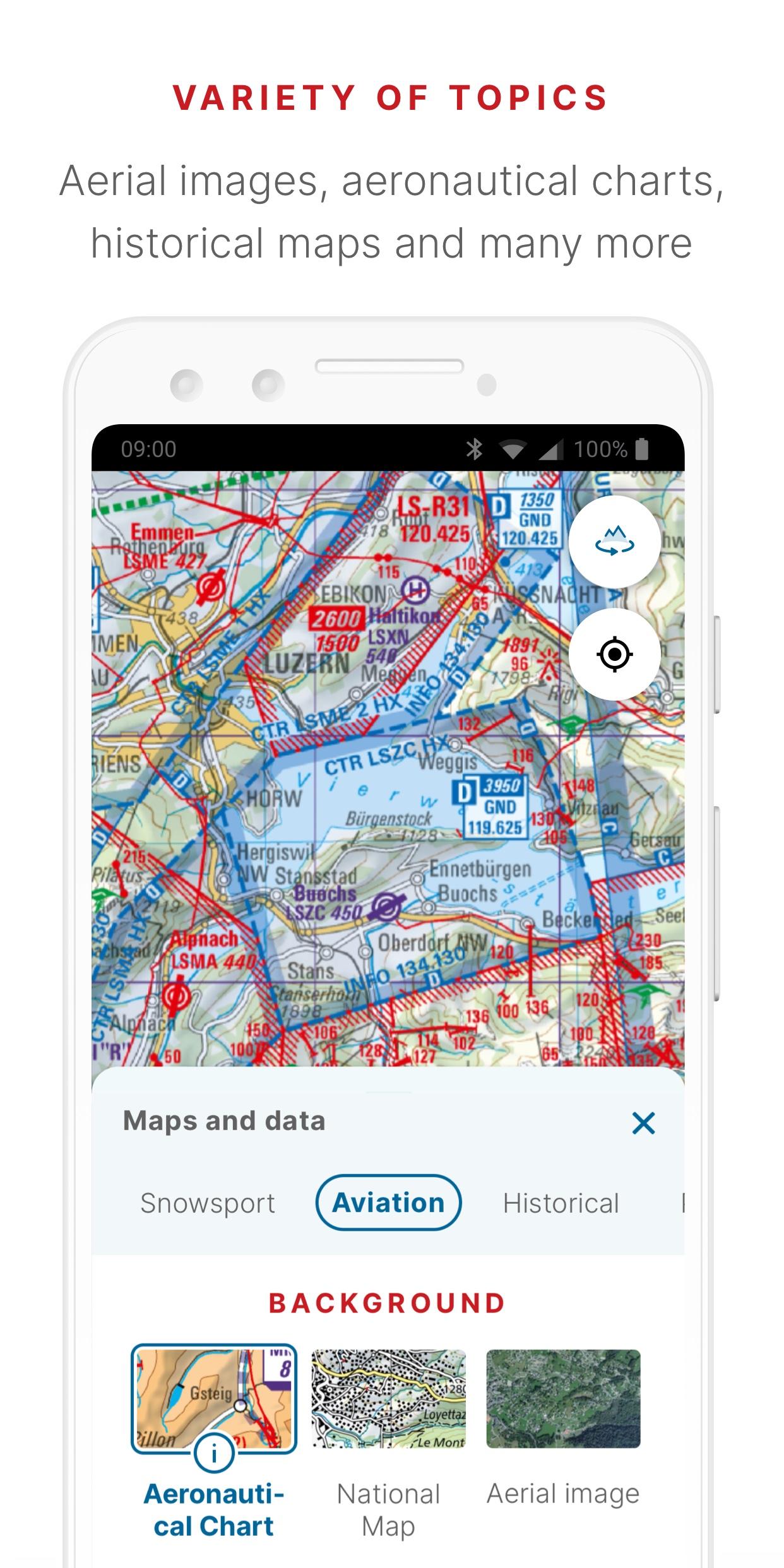
- current aerial image and historical maps
- official hiking, mountain hiking and alpine hiking trails
- closures of hiking trails
- snowshoe and ski routes
- SwitzerlandMobility routes
- public transport stops
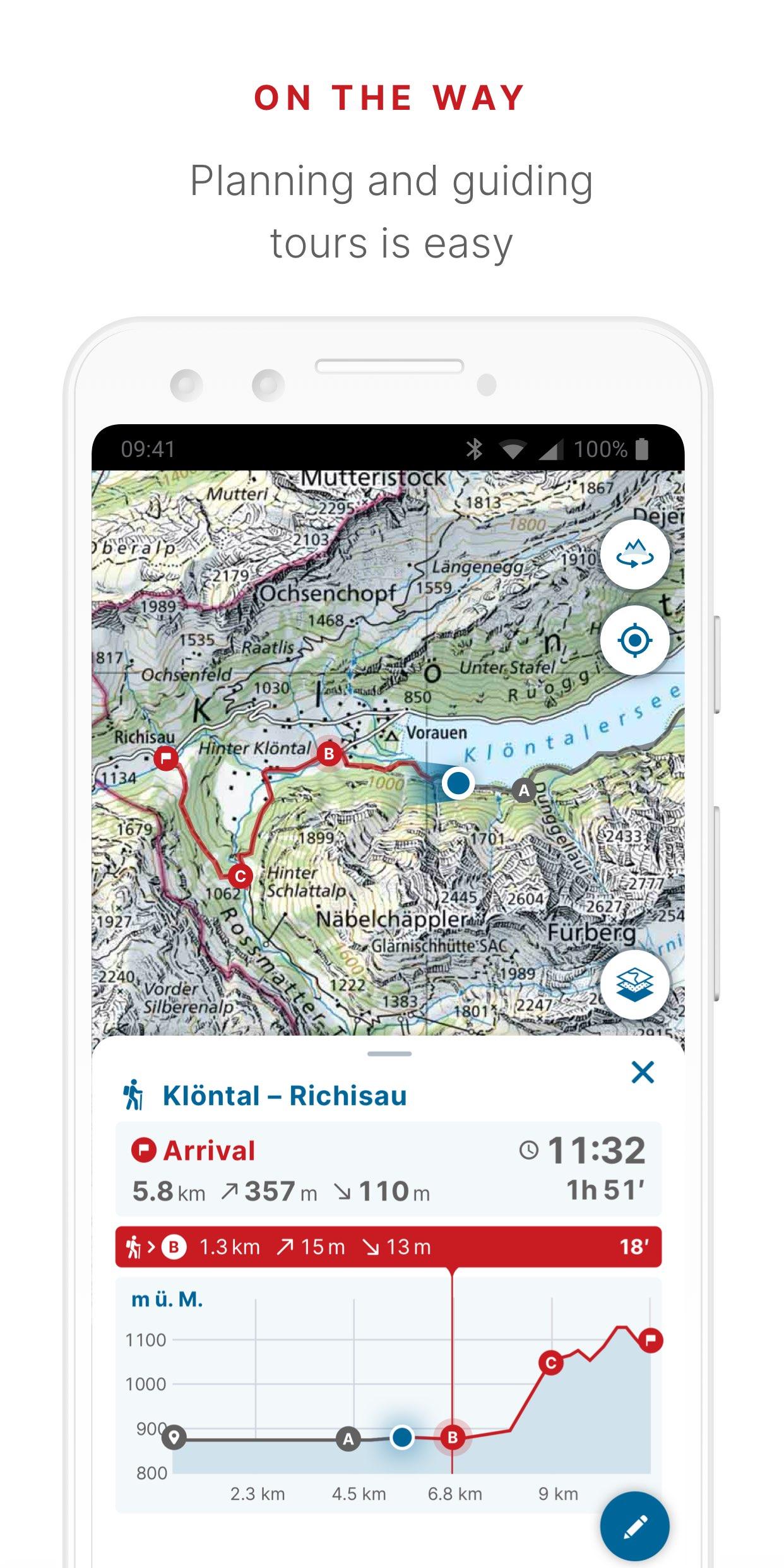
ON THE ROAD
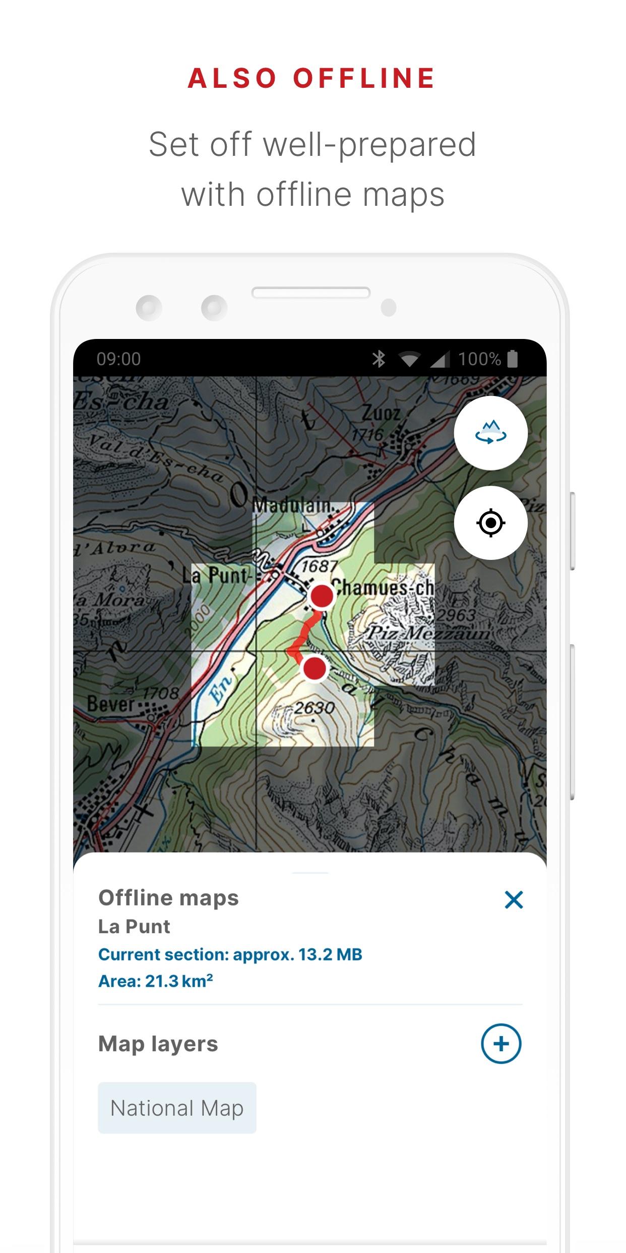
- free offline maps (1:25 000 to 1:1 million)
- draw, record, import and share your own tours
- set tour type (hiking, cycling, mountain biking) and personal pace
- tour guide (arrival time, remaining distance)
- panorama mode (labelled panorama, view tour in "3D")
- save markers, add notes, share
TOOLS such as measure, compare and search (for geographical names, addresses or coordinates)
Report changes to maps and geodata
AVIATION
- aeronautical charts, obstacles, airspaces
- landing sites
- restrictions for drones and model aircrafts
Do you have a question? Then write to us:
SwissTopo: A Comprehensive Geographic Information SystemSwissTopo is a comprehensive geographic information system (GIS) developed by the Swiss Federal Office of Topography (swisstopo). It provides detailed and accurate topographic maps, aerial imagery, and other geospatial data for Switzerland and its neighboring regions.
Topographic Maps
SwissTopo's core offering is its extensive collection of topographic maps. These maps are highly detailed and cover a wide range of scales, from 1:25,000 to 1:1,000,000. They depict various geographic features, including terrain elevation, rivers, lakes, roads, buildings, and vegetation.
Aerial Imagery
SwissTopo also provides high-resolution aerial imagery captured from various platforms, including airplanes and satellites. This imagery is orthorectified, meaning it has been corrected for distortions caused by the curvature of the Earth and camera angle. It offers a realistic and up-to-date view of the landscape.
Other Geospatial Data
In addition to topographic maps and aerial imagery, SwissTopo provides a wealth of other geospatial data. This includes:
* Administrative boundaries (e.g., cantons, municipalities)
* Land use data (e.g., forests, agricultural areas)
* Geological data (e.g., rock formations, soil types)
* Hydrological data (e.g., river networks, water bodies)
* Transportation data (e.g., roads, railways)
Data Formats and Access
SwissTopo's data is available in various digital formats, including shapefiles, GeoTIFFs, and WMS/WFS services. This allows users to easily integrate the data into their own GIS applications and workflows. The data can be accessed through SwissTopo's online platform, as well as through third-party data portals.
Applications
SwissTopo's data and services are widely used in a variety of applications, including:
* Land use planning
* Environmental management
* Infrastructure planning
* Tourism and recreation
* Education and research
Accuracy and Reliability
SwissTopo's data is renowned for its accuracy and reliability. The office uses advanced surveying and mapping techniques to ensure the highest possible quality. Regular updates and revisions ensure that the data remains current and relevant.
Conclusion
SwissTopo is an indispensable tool for anyone working with geospatial data in Switzerland and its surrounding regions. Its comprehensive collection of topographic maps, aerial imagery, and other geospatial data provides a detailed and accurate representation of the landscape. The data is easily accessible and can be integrated into a wide range of applications. SwissTopo's commitment to accuracy and reliability makes it a trusted source of information for professionals and the general public alike.
Information
Version
1.15.0
Release date
Jul 18 2024
File size
70 MB
Category
Maps&Navigation
Requires Android
Android 8.0+
Developer
Faiz Ocix
Installs
500K+
ID
ch.admin.swisstopo
Available on
